The NIMT had hardly opened when the Railways Department was having a look at how they could improve the route. Early attention was given in a number of areas, particularly around Auckland, and between Kakariki and Greatford where there were several grades of around 1 in 50 that were significant limitations on the operations of trains at the time. Hence we find this report from the Wanganui Chronicle of 29 September 1915 describing the improvements of which there were two at that time.
To the best that I can determine at this stage therefore the works were located as follows:
An old map I found being advertised on Ebay confirms the route that was altered in 1915 just to the south of Kakariki as no other maps were found confirming it and this shows the original route was close to where the highway goes today. I haven’t been able to see if there are any ground works that are still in place that confirm the exact route, although there do appear on GE to be short pieces of embankment at each side of the bridge that would have been over the Rangitawa Stream. The gradient here was improved from 1 in 53 to 1 in 70. Other points of interest on this map include the woolscour plant just south of Kakariki which had its own siding, and the bridge just north of the station which was originally a combined road-rail structure. This was replaced about 1940 by the present rail-only structure, and the old single lane Howe truss was replaced for road traffic subsequently by the present concrete structure a little upstream. There is a kink in the rail to the south of the bridge as confirmed by Steve Watt’s photo which was made at the time to align the track onto the new bridge. Have a look through Steve’s album of pictures to see the siding into the woolscour plant. Kakariki closed to passenger services in 1955 and to freight in 1982 except for the siding traffic. The crossing loop was removed in 1984. The woolscour was probably a freezing works originally as there was one located at Kakariki which was operating in 1940.
Here is a newspaper photo of the bridge being rebuilt in 1940.
Whites Aviation of Kakariki with the woolscour plant as it was then described in 1975, the sidings of the station can be seen and there was also a siding going off into the pits, these sidings will be added to the map which will be updated probably tonight and republished. The post-1915 Rangitawa Stream bridge can be seen to the upper left along with the beginning of the curve of the old route.
The second realignment made at around the same time appears to be immediately around Greatford station which is the next station north and is still operating as a crossing loop today.
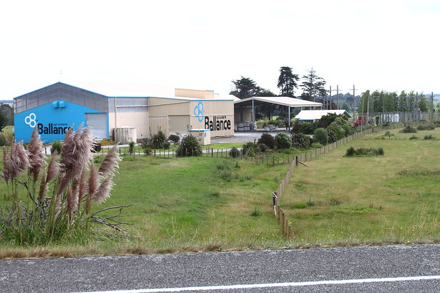
The Greatford station which used to be more into the township area of the time (well gone now, but the street boundaries can still be seen on the map) was moved at the same time as building the deviation and ended up being to the north. Why the station was moved is not immediately clear as it would have been possible to reuse the existing site to some extent since the lines are only about 75 metres apart. In between the two routes is the Ballance Agrinutrients plant which was probably a siding customer of the railways at some time due to its proximity to the line. I haven’t yet been able to view anything on aerials to confirm where a siding might have gone so have not drawn the plant on my map this time.
Here is the plant and we can see the old route going down the fenceline to the right of it (Steve Watts photo), looking north.
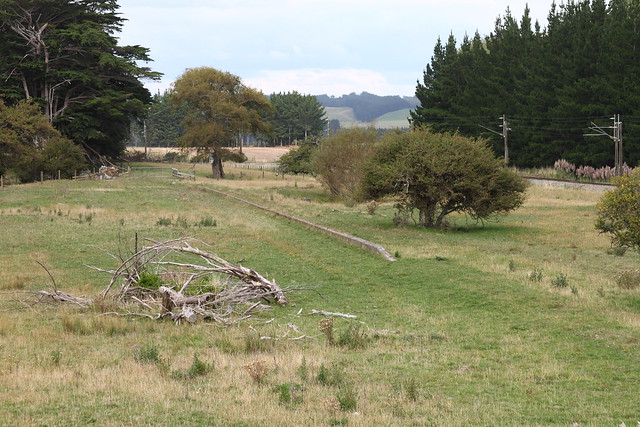
We can confirm the location of the old Greatford station from another of Steve’s photos which is the old platform edge as shown below. This is just east of the highway bridge, and is clearly visible on GE still today.
This obviously closed around 1915 and may have been a passenger station up to that point. The current station to the north is currently a crossing loop and “Dates and Names” says it closed in 1983 (presumably just for freight services).


