Sunday 30 January 2011

Rimutaka Railway (Part 1)

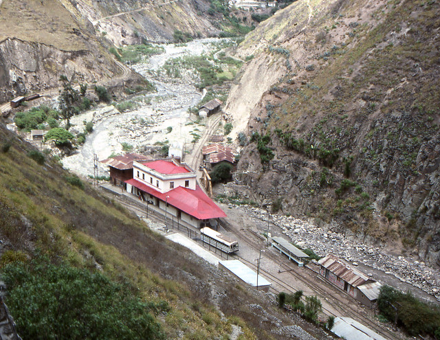
Here we are, a couple of quite short postings on the “Rimutaka Railway”. By which, I mean sort of what is covered by the book of the same name, the old line from Upper Hutt to Featherston.
I don’t have the time I had hoped to write these articles so for now we are just going to have a quick look at some map sections to fill out the details. With the reorganisation of maps the first of these is the Wellington City Transport Map, the relevant part of which appears below.

View Larger Map
Now here are some subsections with comments about features displayed. As everyone knows both old and new routes are often quite close together, with three junctions and three crossings.

View Larger Map

View Larger Map
Starting from Upper Hutt the first road crossed was apparently a level crossing instead of the current bridge. The old line crossed over the top of the new within a few hundred metres. The old route then wound its way around through a series of cuttings and embankments. Subdivision development is now moving into the area threatening the remains today.

View Larger Map

View Larger Map
Cruickshanks Tunnel was the first on the line and along with the adjacent Mangaroa River bridge took the line into the Mangaroa Valley. The remains of Mangaroa station, the first out of Upper Hutt, can still be seen in Flux Road. There was an army siding nearby for some years.

View Larger Map

View Larger Map
At Maymorn on the deviation, the two lines are now about 0.5 km apart. The green line shows the approximate route of a temporary link line used during deviation construction. The second green line at Maymorn shows the corridor that the Rimutaka Incline Railway Heritage Trust proposes to use to link up the old and new routes. It's not clear if they will follow the direct line as this has an average grade of about 1 in 20.

View Larger Map

View Larger Map
At Maymorn the Rimutaka Incline Railway Heritage Trust is establishing its base. The Trust proposes to reopen a heritage railway over the former Rimutaka Railway and Incline. The map ends at the western portal of the Rimutaka Tunnel. The old route crossed over the top of the tunnel at this location.
Just a note on that first level crossing at Upper Hutt. The new route was lower than the old so putting in the bridge alongside the crossing would be almost impossible. Hence I postulate that this old line was probably taken out rather than having them next to each other, remembering this initial section of the deviation wasn’t fully completed until the old line had been closed.
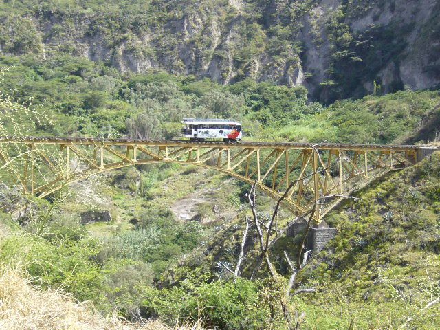
Now as we know, the Rimutaka Incline Railway Heritage Trust has been established and is building up its resources at Maymorn with a view to reopening the Incline and the connecting trackage at either side. There is a certain amount of politics that accompanies the formation of yet another rail heritage organisation in a region the size of Wellington. I’ve got no particular issue with the establishment of the RIRHT as such. Rail heritage like all community and social organisations evolves continually and new organisations are established and take over from the old. One area where the RIRHT is quite forward looking compared to most of the rail heritage establishment in NZ is their use of the internet, including full publication online of all their newsletters. In a lot of current societies you will find this backward approach of selling these newsletters to subscribers – which I think is mistaken as the opportunity exists to publicise the activities of the societies to outsiders who are not getting this information any other way.
The acid test for the RIRHT will come in the next few years as it becomes necessary for them to make definite moves towards establishing the physical track they expect to operate on. This is what will establish them definitively as a serious player in the operation they are seeking to establish, rather than just another slightly different flavour of rail museum. I think with the stage of development they are now at, they should be seriously going for the resource consents and public hearings now, rather than spending a lot of time on their base site or their rolling stock. The whole premise they are founded on is dependent on establishing the rights to operate on that route and it is not a simple process to obtain the rights so getting the legal issues, which will take years to sort out anyway, is a good next step that still gives time to do some of the rolling stock and other core work as well.
On two of the above maps you can see the green lines that show connections between the old and new lines at Maymorn. The first of these is the route that was actually built and which still appears on maps and can also be seen on Google Earth. When the tunnel works were started the connecting track from Upper Hutt had not been laid so this connection was constructed in order to get materials in by rail to the site. It is very steep in parts with some gradients as much as 1 in 30. GE’s elevation profile shows an average grade of about 1.2% or 1 in 80. The RIRHT need to make a similar connection due to the fact that they have chosen not to reopen the old route from Upper Hutt to Mangaroa. Their route is shown as a corridor on some official documents of the Upper Hutt City Council. It would apparently make use of the unused space for a second track on the Maymorn Road overbridge then turn sharply and cross over Parkes Line Road with a bridge over it, then head more or less south until turning again to link up with the old route. It would need to climb quite sharply to get up to the bridge over Parkes Line Road and the ridge immediately south of it and this would make quite a challenge for operation. If Google Earth is right the average gradient is something like 5% or 1 in 20, which is certainly possible but very steep, so some means may have to be found to increase the track length over the straight line.
In recent years one of the positive developments of the area is a public access track from Parkes Line Road up to the Tunnel Gully section of the former railway, making it possible to take a mountain bike up on the train to Maymorn and cycle this part of the route, which has been established as such. This is shown on subsequent maps as being part of the Rail Trail over the route and will be covered as such in Part 2 of this series.

Wednesday 26 January 2011

Two bladed chopper

A2000_20110125_003
This flew over today. Very noisy. Headed over towards Banks Peninsula. It’s a two rotor helicopter.
I have tried to work out what type this is. A couple of NZ operators have Kaman K-Max choppers in NZ which are a tandem rotor type. However this one doesn’t appear to meet the physical appearance of the K-Max I have seen in photos.
bluebus tells me it is a Kamov KA32. This is a Russian helicopter first built in 1969. As it transpires, this one went onto the Araon (see posting below). MRC Aviation Blog records that it was shipped to NZ through Ports of Auckland and flew down from Ardmore yesterday to the ship where it has been hangared on board for the next trip to Antarctica, along with a Squirrel. The Araon has now left Lyttelton – I don’t know when, but last night the webcam showed the berth is empty. The BBC Ems is due in late tonight and as mentioned earlier will be here for just one day loading up to go to McMurdo.

Monday 24 January 2011

Yike in production

A2000_20110117_006
Here’s a Yike out in Christchurch that I happened to see while I was riding a bus recently. They are retailing at about $5000 in NZ.

Korean research icebreaker in Port Lyttelton

A2000_20110123_018
RV Araon is a South Korean research icebreaker of approximately 7000 tonne displacement. It was completed at the end of 2009 and made its first voyage in January 2010, travelling from Korea to Lyttelton, a distance of some 11000 km, before heading towards the South Pole. The ship supports South Korean polar stations in both Arctica and Antarctica. The country had an existing station at King George Island in Antarctica and during the 2010 voyage opportunity was taken to survey a site at Terra Nova Bay, some 350 km north of the US and NZ bases at Ross Island. According to the Lyttelton Port Company website, the ship has come up to New Zealand from Terranova and is scheduled to return there after the completion of its port visit.
Next week another interesting visitor will come into the port and tie up at the same wharf: Briese Schiffahrts’ ice strengthened container vessel BBC Ems, said to be on its way to “McMurdo”. It is already in NZ waters being due to dock at Auckland tomorrow evening, and should reach Christchurch at about midday on Wednesday 26th January for a 24 hour stopover. Ems is another fairly new vessel having been built in China in 2006 and is 17500 tonne deadweight. It can carry 958 TEUs. Its main engine produces 7000 kW and it has three cranes fitted. Based on the destination it would appear Ems is here to make the annual cargo delivery voyage to McMurdo Sound in support of the US and NZ Antarctic Programmes. MV American Tern as previously mentioned carried out this role up until its last trip a year ago. Ems would be expected to return to Christchurch on its way home in order to offload collected cargo from McMurdo before heading back north.
There is also a voyage by a tanker, however it is generally using a US Navy tanker and it’s unclear what route this vessel takes on its way to and from the Ice.

Thursday 20 January 2011

Coal mining past present and future links with rail development & heritage (West Coast / Canterbury, South Island)

Coal mining is a past, present and future industrial activity in NZ. Rail heritage is inextricably connected with coal whether it is from heritage railway operations, access to historic sites or interest in current facilities development for the production of coal. This article does not have any position on the merits or detractions of coal mining itself. There is a list below of current/historic mining operations and their relation to rail and heritage in the South Island West Coast and Canterbury regions. This list may well be incomplete. It is the major mines only, it would take me forever to hunt down all the many mines particularly smaller ones.
Name Location Status/Notes Rail/heritage significance
Stockton Mines Stockton Production Stockton inclined railway
Seddonville State Mines Seddonville Closed [1] Seddonville branch railway
Mokihinui Mines Seddonville Closed [2] Seddonville branch railway, recovered WB locomotives
Charming Creek Mine Seddonville/Ngakawau Closed Seddonville branch railway, Charming Creek tramway
Waimangaroa-Denniston mines (Banbury, Koranui, Wharatea, Coalbrookdale, Sullivan, Cedar, Burnetts Face) Denniston Plateau Closed [3] Conns Creek branch railway, Seddonville branch railway, Denniston Incline, Koranui Incline, Banbury Skip Road
Cascade Mine Denniston/Cascade Production [4] Stillwater-Westport Railway
Escarpment Mine Denniston Plateau Development [5] Proximity to historic features
Millerton Mines Millerton-Stockton Closed [6] Millerton inclined railway
Canterbury Coal Co Homebush Production [7] Whitecliffs branch railway
New Creek Mine New Creek/Cascade Production
Pike River Paparoa Range Suspended [8] Ikamatua rail loading facility
Strongman Underground / Opencast Mines Nine Mile, Greymouth Closed [9] Rapahoe branch railway
Mt Davy Underground Mine Seven Mile, Greymouth Closed [10]
Liverpool Underground Mines Rewanui (Seven Mile), Greymouth Closed Rewanui branch railway
Spring Creek Underground Mine Rapahoe, Greymouth Production
Terrace Mines Reefton Closed [11]
Blackball / Roa Mines Blackball Production [12] Blackball branch railway
Rockies Mine Granity Production [13]
Burkes Creek Reefton Production [14]
Island Block Reefton Production
Echo Reefton Production [15]
Giles Creek Reefton Production [16]
Berlins Creek Berlins Production [17]
Springfield Mine Springfield Closed [18]
Mt Somers Mine Mount Somers Closed [19]
Avoca Mine Avoca Closed [20]
Boatmans Mine Cronadun, Reefton Unknown [21]
Notes:
  1. Seddonville had the country’s first State mines operating in Chasm Creek.
  2. Mokihinui Mines operated in Mokihinui River / Coal Creek and were privately owned.
  3. Sullivan West underground mine was Solid Energy’s last mines on Denniston Plateau, closing 1996. After closure of the Denniston Incline, coal was transported to Waimangaroa where it was loaded at the East Backshunt into rail wagons. In the last decade Department of Conservation have restored parts of the Denniston Incline and Banbury Skip Road along with public access to much of the Plateau. Cedar Mine or other nearby is currently burning.
  4. Cascade Mine has been in production nearly 100 years. Coal was originally flumed down to Cascade station in the Stillwater-Wesport Railway, Buller Gorge, well before the public opening of that section. It was railed to Westport. However Cascade station has been closed many years suggesting coal has been trucked across the Denniston Plateau latterly. It appears Cascade has been privately owned for much (all?) of its life. The current operation is opencast.
  5. Escarpment Mine is a historic underground mine being redeveloped as opencast by private interests (Bathurst Mining with L&M Coal). It is due to open in the next 2-3 years. Under the development proposal, coal will be slurried to Fairdown on the coast for rail loadout.
  6. Millerton’s historic mines are in the vicinity of Stockton Opencast mine. Stockton Mines are planning to opencast the historical workings which are in some areas burning.
  7. Canterbury Coal Co’s Malvern operations have historically been privately operated for about 100 years or more in the Whitecliffs area.
  8. Production at Pike River underground mine has been suspended since 19 November 2010 when an underground explosion killed 29 mine workers. The mine’s future remains uncertain as it is in receivership and various inquiries are ongoing. Currently coal stockpiles are being transported and loaded as receivers look to realise liquid assets.
  9. Parts of the Strongman underground mines have sealed up since the 1967 explosion that killed 19 workers. In the 1990s as the remaining underground mines came to the end of their lives, fire broke out in some of the workings. Solid Energy is required to manage and control these fires as part of its environmental remediation works in the area.
  10. Mount Davy Mine production was suspended twice after death of three workers in accidents. The mine was permanently closed after the second occasion and is being rehabilitated.
  11. Terrace Mines were privately owned until Solid Energy bought them out in 1988. Since SE’s closure the mine has been sold December 2010 to Crusader Coal.
  12. Several mines have been historically developed in the Blackball area. Currently only Francis Minings’ Roa underground mine is operational. In 2006 a worker at the Roa Mine died in an accident.
  13. Rockies Mine is located on the hill above Granity, and very close to Stockton Coalfield. It is owned by the private company Rockies Mining, which is based in Greymouth but has its registered office in Ashburton. Solid Energy also mine an area called “Rockies” at Stockton.
  14. There are currently two mining operations at Burkes Creek; one that Solid Energy took over from a private owner in 2004, and the separate Burkes Creek Coal Party.
  15. Francis Minings’ Echo mine is said to be at the end of its economic life in recent commentary.
  16. Giles Creek opencast mine is operated by Birchfield Coal.
  17. Heaphy Mining operates Berlins Creek opencast mine at Berlins, near Inangahua.
  18. Few details are known at this time of the mines at Springfield except that they were operating in the 1940s.
  19. Various mines have been developed historically in the Mount Somers area. The last underground mine was operational into the latter half of the 20th century but the date it was closed is somewhat uncertain. A small scale open cast mine was operational in the late 1990s but appears to have closed since.
  20. The Mt Torlesse Coal Co’s mines at Broken River were active between 1917 and 1928. Many remains can still be found today.
  21. Not much can yet be found about Boatmans [Creek] mine. There was an accident in 1985 that claimed 4 lives. A company holds a mining permit for the general area under the name of Boatmans Opencast allowing for both underground and opencast operations.
The maps particularly SWL_Main, SWL_Other and ML_Other are being updated with all of the known mining locations in the Buller coalfield.

Monday 17 January 2011

Some Youtube clips of DOC rail history projects

Hapuawhenua Viaduct Opening
Hapuawhenua Viaduct Restoration


Ongarue bush tramway spiral clearing.
Denniston mine restoration part 1
Denniston mine restoration part 2

Sunday 16 January 2011

Fordell-Turakina and New Plymouth deviations

Fordell-Turakina has been covered here before I am sure although the article is not part of this second edition of this blog. However there is new Geoeye coverage of a significant part of the former route. Here are some features.

View Larger Map

View Larger Map
Junction at Turakina with a bridge across the river and then crossing SH3. Ratana Pa township and the station.

View Larger Map

View Larger Map
Whangaehu station site. Possibly a ballast siding at the Whangaehu River along with the bridge of which 2 piers still remain

View Larger Map

View Larger Map
The highway at Whangaehu used to make a sharp S bend and crossed the railway line about the same location where the current highway crosses the old formation. This horseshoe and other curves are found as the line climbs out of the Whangaehu valley.

View Larger Map

View Larger Map
I postulate that this is about where the Bakers Siding station was. The old Fordell station was here. Google Earth's elevation profile suggests that Fordell was roughly the highest point on the old route with steep grades either side.

View Larger Map

View Larger Map
Not far from Fordell the old line is on a hill high above the current route as it descends steeply towards it. Northern junction of old and new lines. The old route was about 22 km long.
Continuing on using the same map file we have the deviations at New Plymouth. I previously wrote about this subject on a blog with no details. Here are some:

View Larger Map
This green line is a guess at where the main line used to be. Supposedly this deviation was done over a hundred years ago. I need to do more work on determining where the old line might have gone. There have been further changes in New Plymouth of recent years, mainly that the old station site was closed down in the 1990s and all the freight traffic moved to Smart Road. There is nothing to be found now of the old station. As far as the 1907 deviation goes, you are said to be able to find where the old route crosses the river because there are still some bits of bridge foundations somewhere in the area.

Wednesday 12 January 2011

State Highway 2 Matahorua Realignment Nears Completion (Part 3)

Here is a Youtube clip of driving the old route by geoff_184:


One feature of this project I was not aware of but which has occurred is the demolition of the Kahika highway overbridge, which is at the south end of the old route. A deviation road and level crossing were constructed to allow for the demolition, which was completed about October 2010. You can see the site of the old bridge and demolition rubble near the end of this clip, with the level crossing reached right at the end of it.

If you refer to the previous articles, the maps have been updated with this information.

I presume NZTA has elected to demolish this bridge because they did not wish to be responsible for further upkeep of it. When the Awatere road-rail bridge was bypassed with a new road bridge several years back the road function of the old bridge was removed almost immediately. Of course, this raises the question of whether the rest of the old road is going to be dug up etc as well. As the route includes a concrete bridge over the Matahorua Stream I wonder if that will be knocked down as well.
Obviously the demolition of an old bridge at the conclusion of such a project is nothing new, however the demolition of a (presumably) reasonably modern bridge which isn’t falling down and isn’t in the way of the new road is something else. Unless it turns out that the Kahika overbridge was old, run down and on its last legs.

Saturday 8 January 2011

Other NZ transport blogs

This blogging thing is taking off and there are several other transport related blogs in NZ which I’ll list below. I don’t take feeds from any of these as there is too much information coming in to be able to read it all. However I do use these on occasions as sources
  • http://nztaxiblog.com/ – Anonymous blog about the NZ taxi industry.
  • http://www.bettertransport.org.nz/ – Campaign for Better Transport. A blog and forums, this is a well organised lobby group which focuses on a variety of different transport modes, mainly in Auckland.
  • http://transportblog.co.nz/ – Auckland Transport Blog. Very detailed and regular postings, and most of the links on this page are in their blogroll. A bit of politicking but my main issue is the feed which should be summarised (as is pretty common in RSS), instead of full posts and content which is what actually comes out.
  • http://aucklandinfrastructure.blogspot.com/ – Auckland Infrastructure. Claims to be “more balanced” than other blogs of this type (in public vs private infrastructure etc).
  • http://www.aucklandtrains.co.nz/ – Auckland Trains. Mostly Auckland, “news and debate”. I like the news but not the debate (see below).
  • http://chchtransport.wordpress.com/ – Christchurch Transport. Mainly bus focused. Concise, focused posts several times a week.
  • http://buswatchnz.blogspot.com/ – NZ In Transit. “Independent public transport news, advocacy” etc. Personalised style produces tendency to long rambling opinionated posts.
  • http://farefreenz.blogspot.com/ – Fare Free NZ. Anonymous blog about “New Zealand perspective in the international urban transport fare-free movement”.
  • http://news.jayride.co.nz/ – Carpool and ride sharing (NZ). Interesting idea for a blog.
  • http://wellingtontransport.wordpress.com/ – Sustainable Wellington Transport. Focusing mainly on public transport and cycling etc, politics and lobbying towards the same end.
  • http://can.org.nz/ – Cycling Advocates Network. “CAN is New Zealand's national network of cycling advocates. We work with government and local authorities on behalf of cyclists, for a better cycling environment.”
  • http://spokes.org.nz/ – Canterbury Cyclists Association. An affiliate of CAN. I get their regular email newsletter, which strikes a reasonable balance without wasting space.

Wednesday 5 January 2011

State Highway 2 Matahorua Realignment Nears Completion (Part 2)

Continuing from Part 1 here are some scenic views of the soon to close old highway (images courtesy of Google Street View).

View Larger Map
Approaching from the north-east this time, the new highway will be so seamless that you probably won’t easily notice the old route curving off to the right, although those tall trees will be a giveaway.

View Larger Map
The rail overbridge might be filled in one of these days.

View Larger Map
The rail line is right at the top of that rockface, a pity you can’t see it.

View Larger Map
Better keep your eyes on the road and don’t get distracted by that railway viaduct overhead (or the road viaduct that’s also visible now).

View Larger Map
Bet this old concrete road bridge won’t be disappearing anytime soon.

View Larger Map
Maybe not this overbridge either.

View Larger Map
View from the south end, will the road onto the old overbridge be kept open? How obvious will it be?

State Highway 2 Matahorua Realignment Nears Completion (Part 1)

The $30 million realignment of part of State Highway 2 at Matahorua Stream is nearing completion and NZTA has invited the public to preview the new section of highway prior to its February opening. The section of highway is directly adjacent to the Palmerston North Gisborne Line railway at the Matahorua Viaduct, which itself crosses over the old highway. In addition the old highway section incorporates two additional grade separated crossings of the railway line. These three crossings are replaced by a single new bridge over the railway. The existing highway bridge over the Matahorua Stream about 100 metres downstream of the railway viaduct will be replaced by the new concrete viaduct just upstream from the railway.
Refer now to the map below for a detailed description of the old and new routes.

View Larger Map
As is the customary practice on these maps, specific roads are shown as black lines while the railway in this case is a red line. Symbols are used to highlight specific features.
Starting from the bottom left corner, the old highway (still open at the time of writing) takes a sharp S bend across the railway via an overbridge which required drivers to reduce their speed to 45 km/h (quite significant when the open road speed limit is 100 km/h, although the bridge grade would also encourage speed retardation for most drivers regardless). The bridge itself was probably originally a grade separation project of earlier years when curvature radius was not such an important consideration, as up and down the country many such overbridges with similarly restrictive approaches dating from the first half of the 20th century are gradually being replaced (such as the one at Waipukurau last year). Travellers continuing north-east soon encounter a further succession of highway condition warnings, including one for falling rocks in the gorge where the highway passes under the railway. (Presumably since the demise of passenger and stock trains on the line the risk of being hit by falling materials from the train itself is lessened these days).
Since old and new highways cross over in the gorge, I’ll now contrast the new highway up to the point where the routes cross over. Once the new section is opened, traffic from the south-west will simply continue straight on without crossing the railway, executing a gentle right hand turn that probably will not require any speed reduction and will not have the severe grade changes of the current route. As it crosses the gorge at its top the unstable rockface alongside which the current route runs is bypassed. A new concrete viaduct will give travellers a sidelong view of the Matahorua rail viaduct where previously they would have seen it from underneath at a considerable height difference. Before it gets to the viaduct, the old route descends into and runs through the gorge of the tributary Kahika Stream and at the confluence it crosses the Matahorua and makes use of its gorge for a time before climbing out. It is the use of these gorges that makes this a challenging section of highway in many ways and eliminating them is the obvious goal of the highway project.
Back on the old highway and after crossing a curved 1930s style concrete bridge we are going under the Matahorua railway viaduct built around the same time. At this point travellers would also have seen the new highway viaduct in the last year or two. There have been several highway closures in recent months to allow sections or components of this viaduct to be lifted into place. After this the highway is climbing out of the gorge over the next kilometre. The opportunity to gradualise this over the whole length, as would be done today, again seems to have been lost on road builders of the era, and consequently there is another short sharp shock at the exit of the gorge, incorporating a passing lane for uphill traffic. As the end of this lane is reached, the rail overbridge with its height restriction warning is encountered. This bridge is fitted with protection beams as some other bridges have been, which suggests it may have been hit by overheight road vehicles in the past. The highway continues its long sharp rightward curvature before reaching a reverse curve taking it past the point where the new highway will join.
On the other hand, travellers on the new highway, after crossing the new Matahorua viaduct, will  take a gentle curve left and pass over the railway line on a new concrete overbridge. I would presume the railway was closed to traffic for periods to enable the parts of this bridge to be lifted into place at various times. The new highway will then curve gradually to the right in order to join the present highway. We can immediately see the compelling nature of these improvements and why this work has been a high priority for improving the highway between Napier and Wairoa, eliminating a narrow twisting road in a gorge with many and severe changes of grade, sharp curvature, visibility restrictions and falling debris from unstable rockfaces as well as the risk of damage to the railway bridge. I expect most of the old route will be closed as there is little land along it that requires public access from it. However, as there is a fairly solid concrete bridge that would have to be demolished, it’s entirely possible the route may be abandoned rather than demolished, or converted to some other function.

Tuesday 4 January 2011

Ecuadorean Railways: Part 4 – Sibambe to Cuenca

Today’s part is fairly straightforward and will look at the Sibambe to Cuenca line. As far as I can tell this started to be built 1915 and was completed 1965, as it is only 145 km this seems like a long time to build a railroad and it was originally to be a private company. Well it is possible part of it was completed in 1965 and the rest (perhaps majority) had been open much longer, who knows?
This is not going to be a long article because today we don’t know much about this line because there weren’t many passenger runs on it latterly and possibly not actually a public passenger service, only excursions. I don’t know when they stopped running but one source on the web suggests the early 1990s, and how this might have come about, is not too clear either.
The Cuenca line joins onto the G&Q at Sibambe, which isn’t on Google Earth, but here is a Flickr photo showing the junction pretty well (thanks to Colin Churcher who has a huge collection of photos on Flickr, with an Ecuador tour set for 1988). 
Sibambe
This is Sibambe which is the junction station. The Cuenca line goes on the left, with the G&Q line on the right. At the time Cuenca was still open. These days with the stop start fortunes of the railway, Sibambe is virtually abandoned. A lot of the other buildings looked to be in pretty bad shape by 1988.
By way of comparison this photo from 2005 is from Wikipedia:
800px-Sibambe_Station2
You can see the difference. There was some sort of township around here once. I can’t quite work out where there was room in this gorge so maybe it was a little further away, unless all those other buildings were the township. The station building is roofless and virtually just a shell.
This recent photo from FEEP, the Ecuadorian State Railways (can’t link) shows that Sibambe station has been restored recently as  part of the line upgrading works and it looks much tidier now.
The story these days (according to Michael Grimes on his Kells Bus Museum site) is that the Cuenca line has been closed by washouts and slips and is probably not going to be reopened.
Here are some more photos from Colin Churcher (limited because his tour apparently didn’t go very far down the line to Cuenca).
Runpast on bridge
Crossing a bridge
Chunchi
Chunchi station (not far from Sibambe)
Sibambe
Near Sibambe. The line climbs quite steeply to get out of the gorge.
Now here is my map of the area in general:

View Larger Map
As you can see not much of the route is in brown colour, meaning there is relatively little Google Earth coverage, most of which is around Cuenca itself.
The table below shows some points of interest on the maps.

View Larger Map

View Larger Map
Tambo station area with the wye. Bridge on the outskirts of Cuenca.

View Larger Map
Cuenca station yard.
These days there is not an undisturbed route into the old station as the formation appears to be taken over in a few places by highway construction and probably the wastewater plant construction. As such you will see a lot of green line drawn around Cuenca due to the apparent formation route being obliterated and there not being any crossings of highway where it would have been needed. This is quite a contrast to some areas of the G&Q and San Lorenzo around Quito where highway crossings have been built as necessary in recent years, all this goes together to point to the closure of the line.
Now we have only the coverage of the G&Q itself for the rest of this series. I expect that will take at least a couple of parts, maybe three. Stay tuned.

Ecuadorean Railways: Part 3 - Quito to San Lorenzo

Today we are going to get into the nitty gritty by having a look at the San Lorenzo line; known formerly as the Northern Subdivision and completed during the late 1950s or early 1960s, it runs from Quito and heads more or less north to San Lorenzo, a planned site of an alternative port that I understand has never been fully developed as such. The other port linked by rail of course being Guayaquil, but the limitations of the G&Q working against efficient freight movement inward, the alternative port was rather keenly sought. San Lorenzo never achieved this, and so today the port has been developed at Manta further south and now a new line estimated (early 2000s?) at some $60 million may well be built in future.

View Larger Map
In the map you can see the G&Q coming in from the south to Quito and the Q&S heading north out of the capital. We have Panoramio to show us some features of the line and I will highlight some of Senôr H Casanova’s pictures (maybe he is the local train spotter who has walked or cycled over much of the route to San Lorenzo). Also there is not full mapping of this line because at the point at the northern end of Google Earth’s current coverage, there is not anything in Google Maps to show where the line went after that.
Looking at the map to begin with shows us that this is very much a contour railway that was constructed to the cheapest possible cost. It covers many ravines and considering that it was started possibly in the same era as our NIMT was completed, that a completely different scenario was used to cross that landscape is rather striking. In the part that I could examine, something up to two dozen crossings were affected by more or less similar means: a long steep approach in both directions to a tight horseshoe curve at the narrowest point of the ravine where it could be crossed at a relatively low level on an earth embankment with presumably a culvert at the bottom to carry the water, or in some cases a bridge. In New Zealand this is more commonly a feature of roads than railways, because the railway needs to be kept straight and as level as possible to enable it to carry high freight volumes. I don’t really have off the top of my head an adequate comparison for any branch line in NZ but I can’t think of any real equivalent that comes to mind. all the ones that I can think of are roads like the highways near some of our highest railway viaducts that do exactly that. The problem with this approach is the tight curve that you need at the relatively narrow crossing, however in Ecuador such curvature is comparatively routine. The result of these and other decisions is a line that basically zigzags its way across a comparatively flat landscape with only a few hills to begin with. This means of construction has proved to be a fatal flaw as the river valleys are best avoided due to the rainflow, it’s understandable that where most of the damage has been occurring is in those areas and the way to producing a line that could stay open is to stay out of those river valleys and bridge across at the top.
The next question which has not been fully resolved is when the line was abandoned, or at least part of it was; to the north there are still a couple of sections that have operated, at least recently, including Ibarra-Primer Paso (not on this map). What you can see in Casanova’s photos suggests closure or abandonment for a significant period. It’s known that the most severe weather bombs happened in the early 80s and late 90s yet much of the damage of the earlier period was repaired. I believe that it was 1997/98 period of heavy rainfall in particular that has largely been left unrepaired until now and the cessation of through services has allowed the line to quickly show neglect and abandonment.
Here I am going to list some of Casanova’s photos that you can go look at with a commentary (text only, Panoramio does not have a linking API as yet). Some of the photos in this list are also from other authors.
http://www.panoramio.com/photo/39969154 A bridge over a highway with missing rails
http://www.panoramio.com/photo/11700988 A bad washout, rails hanging midair
http://www.panoramio.com/photo/31055035 The right of way being used as the entrance to someone’s premises
http://www.panoramio.com/photo/31079033 A bridge at the side of a ravine
http://www.panoramio.com/photo/31079054 A ravine low bridge crossing
http://www.panoramio.com/photo/31079135 Tunnel
http://www.panoramio.com/photo/31080018 Looking down to the bottom of the ravine we just crossed and have climbed out of
http://www.panoramio.com/photo/31080198 Where’s the track?
http://www.panoramio.com/photo/31080119 Crossing a ravine using the shortest possible bridge
http://www.panoramio.com/photo/34231953 Another bit that looks more like a rubber tyred road, fairly steep too.
http://www.panoramio.com/photo/30981141 Ditto
http://www.panoramio.com/photo/31020076 Looking across a ravine to a tunnel on the far side.
http://www.panoramio.com/photo/31000915 Bridge with tunnel at far end
http://www.panoramio.com/photo/34261426 View of a typical ravine crossing with a bridge in this case.
http://www.panoramio.com/photo/37519702 Another such crossing, this one must have been a high embankment that has washed out.
http://www.panoramio.com/photo/37520860 Tunnel to nowhere… almost
http://www.panoramio.com/photo/37520941 Some trackbed that gives an idea of the line’s problems
http://www.panoramio.com/photo/7201543 An actual train near Otavalo. These guys are a bit more formal about riding on the roof.
http://www.panoramio.com/photo/997396 Otavalo
http://www.panoramio.com/photo/997323 And now for something related not railway…
http://www.panoramio.com/photo/14317771 A high bridge near Ibarra
http://www.panoramio.com/photo/14317798 A local train near Ibarra
http://www.panoramio.com/photo/17577646 View of that bridge from a train
http://www.panoramio.com/photo/36288063 Stone arch bridge near Ibarra
http://www.panoramio.com/photo/37519602 Washout
http://www.panoramio.com/photo/31008451 Bad washout with rails in midair
http://www.panoramio.com/photo/13694966 This is the very simple autoferro turntable at Salinas (Primer Paso) where they turn the railbus at the end of its run.
http://www.panoramio.com/photo/36508296 Salinas
http://www.panoramio.com/photo/13695062 An improvised panorama of the Salinas railway station
Browse the map to see some of the geographic features like a 3 chain curve near Quito, I’ve run out of time so that’s it for today.
I am just coming back to this a couple of days later to comment further on the current operation. Some photos from Flickr are linked below (Flickr allows this). Ibarra-Salinas (Primer Paso) is the remaining 43 km that is open at the moment for tourists. I guess we will see whether any more is fixed up by the government. There are several different railbuses operating the route. It is very obviously geared around that minimalist operation and this is a somewhat sad reflection of how railways have been run down in Ecuador – fortunately I will be able to be more positive about G&Q when I get to writing about that. This means there is a workshop in Ibarra that is just full of old stored rolling stock, locomotives etc that is rusting away to oblivion.
I found one complete photo album on Flickr that has a whole trip worth of photos. That day there weren’t many people who wanted to travel so they went along for the ride with a repair gang in a very small railcar: http://www.flickr.com/photos/9874810@N02/sets/72157601593391119/with/1196701862/
The rest of the photos below are taken from various Flickr albums including some from the album mentioned above.
Tren-Ibarra-Salinas
A bridge in the operational Ibarra-Salinas section with a railbus.
Whistle stop
From other photos this appears to be the Salinas station.
Working on the railroad
A work gang installing some “sleepers” or “ties” (they had run out of the regular kind so they were using the trunks of small trees).
Train
The workshop at Ibarra with the small railcar they were using that day.
I have seen some photos that I can’t link that showed sleepers being unloaded at this workshop – dated about a year ago. The text seemed to suggest they would be put into rehabilitating this section. But what about the rest?
IMG_1082
This is from a different album and it shows a different railbus as they are going into a tunnel.

Saturday 1 January 2011

Ecuadorean Railways: Part 2 – Introduction (continued)

Continuing from part 1 and after reading up a lot more. The G&Q railroad and possibly the S&C (Sibambe-Cuenca) started life as a private company. The operation of the G&Q has always been complicated by the climate in Ecuador which has often produced heavy rainfall to damage the lines with landslides or washouts. So it was that in 1925 the privately owned railroad company was sold to the Ecuadorian government because, it would seem, they didn’t want to repair the line any more. The climatic problems in fact caused a change in the route of the railway in the first place, the change that resulted in the obstacle of Nariz Del Diablo being encountered with its challenges. I wonder if there is still any trace today of this earlier constructive work of the railway. At any rate, much of the development was done in the private railroad era, and after that it was mostly downhill. The finances of the railway, so I read, were not good except in the 1920s and again during World War II. The main headquarters were developed in Huigra and the workshops in Riobamba, and these still exist in some form today. Efforts have been made to dieselise in stages over the recent decades, but steam still exists as no money could be found to buy spares for the modern locomotives.
A diagram showing the distances, altitudes and gradients is here. I didn’t include it in the post as I suspect the copyright belongs to the website that is displaying it.
Now it is time to finish off with a map… of course, what else do we put on every page in this blog?

View Larger Map
The coverage of Ecuador in Google Earth has improved quite a lot since I first mapped this line three years ago, but of course there are still gaps, the gap sections are shown in green and are for the most part a direct trace from Google Maps. And then there is a part of the San Lorenzo line that is not actually marked in Google Maps at all. We will go into the map in more detail in subsequent articles of the series.

Ecuadorean Railways: Part 1 – Introduction

Well you know, on this blog we go lots of different places and cover a wide range of subjects. In this series we are going to look at the railways in Ecuador and there are going to be a few parts because there is a lot that is of interest. A brief history to begin with. The fullest extent of the Ecuadorean Railways is about 1000 km of which about half is in the legendary Guayaquil-Quito line, the “G & Q”. The other lines which have been developed are Sibambe-Cuenca and Quito-San Lorenzo. The role of the railway in modern day Ecuador is not very clear. When you look at what has been in the past and what is now, it seems the railway was developed for full service in the past but now is mainly passenger, light freight and tourism. The biggest obstacle the railways have is the topology and the difficulties in overcoming it. The G&Q line has to climb from sea level (4 metres) at Guayaquil to 3229 metres at Palmira in only 166 km. Palmira is not the highest part of the line but it does represent in theory an unbroken ascent, after Palmira the line does drop a bit before it climbs again. Do the maths and you come up with an average gradient of 1 in 50. Let’s revise that a little and split the line into two parts. From Guayaquil to Bucay the track distance is 87 km and the ascent is 290 metres with average grade of 1 in 300 therefore. From Bucay to Palmira the track distance is 79 km and the ascent is 2935 metres, giving an average grade over that section of just 1 in 26. The steepest sections in that are 1 in 18 and this is an adhesion worked railway, it has no rack or any other aids to help the climb up. Effectively such steep grades over such a long section of the railway limits the practical size of any train and therefore its carrying capacity.
Construction on the G&Q line began in 1872 and with the many obstacles to be overcome especially the switchback at Nariz Del Diablo, between Sibambe and Alausi, which contains the steepest 1 in 18 sections, and which had to be blasted out of solid rock resulting in hundreds of deaths, it took until 1908 before the complete line was opened. The other two lines were completed in the middle of the 20th century: Cuenca was opened in 1965 having taken 50 years to build 145 km, while San Lorenzo was opened in either 1957  or 1962 (unsure when it started). The railways of Ecuador played their fair part in the development of the country in the earlier years but like many other countries have been run down in the second half of the 20th century. Although I can’t find full information on the web I understand that the Cuenca line is effectively closed and has been at least partly closed since the 1970s. The San Lorenzo line is partly closed but may be reopened. The G&Q is partly closed at present but is expected to be fully reopened. The main factors affecting the operation of the railways in recent decades have been financial problems, the development of the roads with transfer of traffic, and lack of maintenance. Some parts are currently closed because of landslides and washouts that have not been able to be repaired, and historically the line has been renowned for its reputation for frequent derailments and the operation of very old locomotives and rolling stock.
Now in the 21st century the value of the lines for tourist development has been recognised, I read somewhere that the railway was one of the top 5 attractions in Ecuador and there are a number of companies that specifically organise and run rail tours in the country. The government has borrowed money from Venezuela and has in the last few years started a large rehabilitation program on the G&Q line and on parts of the San Lorenzo line. They have their own website in Spanish and English and are making use of Flickr and Youtube to promote the works they are doing. I’ll finish off this article with a couple of Youtube clips. Here is one off the the official Youtube channel of Ecuadorean Railways that shows the track being reconstructed at Nariz Del Diablo, the zigzag section where the line climbs up the side of a mountain. (Please note it is Spanish language)


The second clip is a ride on a railcar from Alausi to Sibambe and return. From Sibambe at 1836 metres altitude and 131 km line distance to Alausi (2347 metres, 142 km) an average gradient of 1 in 21 is needed. In order to achieve this climb, the line firstly ascends the switchback at Nariz Del Diablo which involves three sections of track in total, with two dead end sections with points. The train heads up the first part, reverses up the middle part and then heads up again into the third section. The second part of the ascent involves a sweeping ascent of a cliff face with two horseshoe curves. The maximum grade on these sections is 1 in 18. The clip is also in theory Spanish language although there is almost no dialogue so it’s not really an issue. They started with the railbus at Alausi, went down to the bottom and came back up again.