Thursday 23 April 2015

Dunedin-Port Chalmers Railway [2]: Ravensbourne-St Leonards

In this section there were a number of larger and possibly smaller realignments. In some areas between the main bays with their various causeways the railway may have been slightly further inland than it is now, but the detail is not there in the source maps to be sure. There isn’t enough detail in the Quail Atlas to be sure of the date of deviation at all of the bays but a date of 1931 is shown around Burkes. Quail also doesn’t show the realignment at Ravensbourne itself.

Ravensbourne

Ravensbourne bay has a causeway and the old railway probably went along the side of the highway. The station may have been a little closer to the highway originally.

Maia

Maia station was between a couple of bays.

Burkes

Quail claims that Burkes station and Maia were the same but my source maps place Maia where I showed it and a separate Burkes station in one of the closed off bay sections. It’s possible that Maia was the replacement for Burkes when the causeways went in, since Burkes closed in 1931 and Maia opened in 1926. Since “Dates and Names” has separate unconnected listings this tends to support they were in separate places and were not the same station at any time.

St Leonards

Just north of St Leonards is another small bay bypassed. In total on this map four bays with causeways are shown.

Wednesday 15 April 2015

Dunedin-Port Chalmers Railway [1]: Pelichet Bay

The Dunedin-Port Chalmers Railway was the first railway constructed in the Dunedin area and was built under the auspices of the Otago Provincial Council. Opened in January 1873, it was part of the NZR network from April that year and had the distinction of being the first railway in New Zealand that was constructed to what became the NZ standard gauge of 1067 mm. The route along the coast north of Dunedin as far as Sawyers Bay has had many alterations over the years, chiefly in straightening and duplicating the line from the early 1920s. The first such section resulted in the reclamation of Pelichet Bay, part of which was already enclosed by the original railway embankment of 1873, by building a causeway in the harbour. The most inward part of the bay became Logan Park, while the part captured in 1924, which had included docks, became industrial land and now includes the site of Dunedin Stadium. From 1925 until 1948 further causeways changed the shoreline all along the route, as many formerly open bays became enclosed. Although the tunnel at Sawyers Bay was duplicated, the second track never reached that station and much of the double track along the route has since been singled due to the reduction of traffic volume since the 1980s.

PelichetBay

To kick things off here is the map around the Pelichet Bay area. The old route of the DPCR which became the Main South Line north of Dunedin, ran along what is now Anzac Ave north of Frederick St. There was a station near the Water of Leith bridge, on what was then the foreshore. At Union St the railway ran along the south side of this street until it reached the end of the diversion. As the map shows this is all around the current Dunedin stadium site. There have been other railway related changes in this area more recently, most notably at the north side of the present MSL, where some sidings were torn up to make way for the diversion of State Highway 88.

The Quail Atlas records that the MSL deviation at Pelichet Bay was opened in 1925. Anzac Ave is supposed to have been built through in 1924. One explanation for the discrepancy could be that the deviation was completed and brought into use with a single track first, allowing the old line to be closed, and then the date of 1925 is when the second track was completed.

There is quite a bit more work to do in updating the rest of the map to Sawyers Bay and additional parts will be published as this takes place.

As happens from time to time the map symbology has been revised, in this case the symbols for rail trail and changed road have been swapped so that the former looks more like a railway track and the latter looks more like a road. The main difference you will see in the above map is that the symbol for “Rail Line Lifted” has been given a thicker border to make it stand out more (see the section next to the stadium for example) and the style for “Rail Reuse Road” as seen on the first part of Anzac Ave now uses the same ellipse overlaid onto the standard road line so they are harmonised.

Other changes made include the tunnel symbols to also make them stand out more and tweaking a few others. This is the 33rd set of map styles since the project began 30 months ago. Obviously I try to avoid making lots of changes all the time but this is a good example of a good reason for making the latest change. Styles are hard to choose as they have to avoid cluttering the map too much and also what looks good in Qgis doesn’t always look the same when it has been rendered into a picture or PDF so a lot of tweaking is needed to get the different styles to stand out from each other and also avoid making the map look too busy. The scale shown above is not commonly used so normally I would have a larger scale in a map like the above one so some of the detail stands out better instead of being crowded together, nevertheless I feel the map above works very well at what is a relatively small scale for these maps.

Monday 13 April 2015

Manaia Branch Railway

The Manaia Branch was a line of about 9 km in length that was developed in the early 1920s from Kapuni, on the Opunake Branch which was also under development at the time, to Manaia, more or less directly to the south. The only official references to it found so far are the following paragraphs from the Public Works Statement (D-1) of the Appendices to the Journals of the House of Representatives (AtoJs) for 1923.

Kapuni Branch: […] The opening-up of the ballast-pit at the Kaupokanui River on the Manaia Branch line has been completed. The access to this pit comprises the laying of 30 chains of siding and branch line, together with a bridge across the Kaupokanui River.

[…]

Manaia Branch (0 m. to 5 m. 49 ch.; length, 5 miles, 49 chains).—The formation and culverts on this section have been completed with the exception of several cuttings and banks which will be widened by work-train, and everything is in readiness to start platelaying.

And there rests the matter. I have not found anything to confirm the line was ever completed or opened. The Quail Atlas tends to confirm the idea that the line was never completed beyond the formation works. Here are the three maps which I have been able to draw showing the route from originals held in the Alexander Turnbull Library collection.

Manaia Branch 1Manaia Branch 2Manaia Branch 3

Thursday 9 April 2015

Early NIMT Improvements Manawatu [2]

Last time in this blog I looked at the realignments that were done around 1915 between Kakariki and Greatford. This was not the last of the changes to the line between the two stations. The works that were addressed then were the easiest to achieve over fairly short distances and without too much earthworks. What we do know is that in the late 1930s, specifically 1936/7, there were two large projects started to improve the line between the stations again after almost 30 years experience of NIMT operation and 20 years since the previous improvements.

The first of these projects as far as I can determine at this time was the improvement of the section of railway between the Rangitikei River and Greatford township.  In this area the railway encounters a notable gradient which can be very roughly quantified by the rise in altitude from Kakariki (70 metres) to Greatford (105 metres), which when averaged over the track distance works out to an average of 1 in 137. But within that area there could easily be a lot of variation and perhaps a better indication is over a short stretch of the route where the line crosses the 80 metre and 100 metre contours quite close together, which is indicated to occur over a relatively short distance of 1 km or less and therefore suggests that in that short stretch around a 1 in 50 gradient is reached. The old line being apparently lower meant this grade could be greater, or over a longer distance, probably a steeper climb overall featured as the old route appears to be at a lower level.

kakariki1937

Although we don’t have total certainty of where this is, it is quite likely that it is at the big 90 degree curve where the main road diverges and cuts across to its intersection with SH1, as the bluffs which can be seen above are probably those which are seen alongside the highway in this area. This is the area known to railwaymen as the Kakariki Bank and the use of the long sweeping curve indicates the desire to spread out the ascent/descent. Since there is not a substantive change in the route overall we can only assume that in this instance the new embankment may have made the grade more even and therefore eliminated one or more sharp peaks or dips in the previous alignment. The newspaper article also mentioned  the objective of eliminating a level crossing, where a small overbridge can be seen opposite the siding into the ballast quarry. The route shown is approximate but is probably the most likely one apparent on GE since the maps are somewhat ambiguous.

KakarikiBank 

The second improvement of the late 1930s was the replacement of the Rangitikei River bridge just north of Kakariki. This being a road rail bridge, it was a period in which many such bridges of this type on busy routes were being replaced. Road traffic had increased greatly in the lifetime of many of these bridges; even though the one at Kakariki has never carried any state highway, it is part of an important secondary route through to Feilding. Unless the bridges had gatekeepers present, trains often had to be slowed to 10 km/h when crossing such bridges, and as the bridge was at least 35 years old, it may have needed repairs or strengthening. Although this bridge was started at the same time as the realignment works and was linked with them in one newspaper report, there does not appear to be any real connection with the realignment because the new bridge was at practically the same height and alignment as the old one.

Kakariki1940

As we can see the old and new are very close together and some traces still exist today of the old bridge like a pier foundation at the north end right next to the current structure. Since this photo was taken in 1940, the bridge had up until this point taken about two years to complete and the foundations with the concrete piers were contracted out, while the Railways Department itself built the spans and moved them into position.

The original bridge at this site appears to date from 1899 in fact even though there was an earlier railway bridge there. There was no road bridge in that area before that time because an earlier bridge existed at Onepuhi, some 5 km upstream. But the Rangitikei River is subject to severe flooding and at various times there has been a lot of damage caused to bridges crossing it, and in fact in 1882 the railway bridge of that era was washed out to the extent of three spans. In 1897 the floods of that year washed out road bridges at Bulls, Vinegar Hill and Onepuhi, and the Kakariki rail bridge was significantly damaged as well. It appears a new bridge which would also carry traffic was constructed after that event and was finished in 1899. However not all of the local residents were enamoured of the new arrangement and as early as 1912 there was agitation for the railway structure, which must have been heavily used with the completion of the NIMT, to again be separated from the purpose of carrying road traffic. Of course this did not in fact happen until March 1941 with the actual completion of the current railway bridge.

The woolscour plant at Kakariki which was shown on the map in the previous post also has a varied history, being originally built in the 19th century as a flax mill, then in 1917 changed to a freezing works which operated for only two years. During World War II it was used for cool storage having been converted with plant obtained from salvage of a ship wrecked at the Wanganui Heads. In 1948 it became a wool scour plant and at the time of its closure in 2006 was owned by Feltex, which went into receivership and was bought out by Godfrey Hirst.

Early NIMT Improvements Manawatu [1A]

Just a quick update to yesterday’s post with revised maps from new information.

KakarikiStn

An overall view of Kakariki with the woolscour plant site updated to its correct size and the siding redrawn, also Kakariki yard drawn in. There was a siding at the north end of the Kakariki yard. Possibly there were gravel pits there, but if so they are not in use today.

KakarikiTrk

Closer view of Kakariki showing the extent of the loop and yard sidings as they were in 1975.

KakarikiNth

Getting north we have another ballast siding just off the bridge which crossed SH1, there is an extensive pit system still in use there by road access. In this photo you can also see the start of another realignment, which is going to be the subject of my next post.

Wednesday 8 April 2015

Early NIMT Improvements Manawatu [1]

The NIMT had hardly opened when the Railways Department was having a look at how they could improve the route. Early attention was given in a number of areas, particularly around Auckland, and between Kakariki and Greatford where there were several grades of around 1 in 50 that were significant limitations on the operations of trains at the time. Hence we find this report from the Wanganui Chronicle of 29 September 1915 describing the improvements of which there were two at that time.

KakarikiWangChron

To the best that I can determine at this stage therefore the works were located as follows:

KakarikiStn

An old map I found being advertised on Ebay confirms the route that was altered in 1915 just to the south of Kakariki as no other maps were found confirming it and this shows the original route was close to where the highway goes today. I haven’t been able to see if there are any ground works that are still in place that confirm the exact route, although there do appear on GE to be short pieces of embankment at each side of the bridge that would have been over the Rangitawa Stream. The gradient here was improved from 1 in 53 to 1 in 70. Other points of interest on this map include the woolscour plant just south of Kakariki which had its own siding, and the bridge just north of the station which was originally a combined road-rail structure. This was replaced about 1940 by the present rail-only structure, and the old single lane Howe truss was replaced for road traffic subsequently by the present concrete structure a little upstream. There is a kink in the rail to the south of the bridge as confirmed by Steve Watt’s photo which was made at the time to align the track onto the new bridge. Have a look through Steve’s album of pictures to see the siding into the woolscour plant. Kakariki closed to passenger services in 1955 and to freight in 1982 except for the siding traffic. The crossing loop was removed in 1984. The woolscour was probably a freezing works originally as there was one located at Kakariki which was operating in 1940.

Here is a newspaper photo of the bridge being rebuilt in 1940.

Kakariki1940

KakarikiWA

Whites Aviation of Kakariki with the woolscour plant as it was then described in 1975, the sidings of the station can be seen and there was also a siding going off into the pits, these sidings will be added to the map which will be updated probably tonight and republished. The post-1915 Rangitawa Stream bridge can be seen to the upper left along with the beginning of the curve of the old route.

The second realignment made at around the same time appears to be immediately around Greatford station which is the next station north and is still operating as a crossing loop today.

Greatford

The Greatford station which used to be more into the township area of the time (well gone now, but the street boundaries can still be seen on the map) was moved at the same time as building the deviation and ended up being to the north. Why the station was moved is not immediately clear as it would have been possible to reuse the existing site to some extent since the lines are only about 75 metres apart. In between the two routes is the Ballance Agrinutrients plant which was probably a siding customer of the railways at some time due to its proximity to the line. I haven’t yet been able to view anything on aerials to confirm where a siding might have gone so have not drawn the plant on my map this time.

Here is the plant and we can see the old route going down the fenceline to the right of it (Steve Watts photo), looking north.

We can confirm the location of the old Greatford station from another of Steve’s photos which is the old platform edge as shown below. This is just east of the highway bridge, and is clearly visible on GE still today.

This obviously closed around 1915 and may have been a passenger station up to that point. The current station to the north is currently a crossing loop and “Dates and Names” says it closed in 1983 (presumably just for freight services).

Monday 6 April 2015

THE WORK AT THE CAVERSHAM STATION, SHOWING THE OLD AND NEW RAILWAY LINES

An old photo from the Otago Witness showing the duplication works through Caversham. The line to the left being higher up would probably be the original line which was bypassed. The lines ran close together through Caversham until they deviated off to their respective tunnels. 1907

http://paperspast.natlib.govt.nz/cgi-bin/paperspast?a=d&cl=search&d=OW19071009.2.269.4

Caversham c.1920

One of the interesting features of this photo is the semaphore signal in the foreground. It seems to be too far from the track, and one possibility is that it related to the old line (pre-duplication), which was higher up the bank (because the old tunnel was higher).

Hocken Library http://hockensnapshop.ac.nz/nodes/view/5941

“Otago's Great Northern Trunk Line Moeraki”

Hocken Library (click on image for entry details)

Caversham Railway Duplication 1907

Appears to be at South Road bridge. This area has changed a great deal in the past 100 years with the duplication, realignment and regrading of the original single track railway, combined with the re-singling and realignment of the railway in the 1980s to allow for motorway construction. (Hocken Library, click on photo for entry details)

Mihiwaka Tunnel

Hocken Library (click on photo to view entry details)

Old Caversham Tunnel

A train leaving the original Caversham Tunnel with Kaikorai Valley Road bridge over the portal. As we can see the signals, the train must have been entering station limits at Cattleyards Station. (Hocken Library, click on photo to view entry details)

Sunday 5 April 2015

Gisborne Line Tunnel 24 daylighted in May 1956

These photos from Gisborne Photo News issue 21 of May 1956 show works underway to daylight Tunnel 24 on the Napier-Gisborne line. The tunnel was removed because it was driven through an active landslide.
GPN21_19560405_005aGPN21_19560405_006aGPN21_19560405_006bGPN21_19560405_007aGPN21_19560405_007bGPN21_19560405_007c
GPN23_19560531_019GPN23_19560531_034aGPN23_19560531_035aGPN23_19560531_035bGPN23_19560531_037aGPN23_19560531_037b

Wednesday 1 April 2015

Puketeraki Railway Tunnel

http://rsnz.natlib.govt.nz/volume/rsnz_70/rsnz_70_03_003990.html

Based on the above information we have the date of the abandonment of the tunnel placed as 1934/5. Specifically

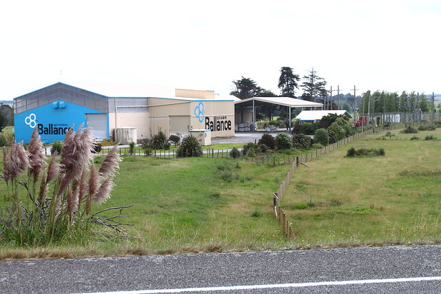
Puketeraki Railway Tunnel.

Some idea of the rate of these slumping movements may be obtained from the records of displacement at the Puketeraki railway tunnel, which through the courtesy of the Otago District Engineer for Railways, the writer was permitted to study (See Fig. 3). The tunnel was cut through a northward-facing bluff of Caversham Sandstone, and enters into what is actually the face of a slump-scarp a short distance above the underlying mudstone. The tunnel is 516 ft. long and rises southwards with a slope of 1 in 66, crossing several major as well as minor surfaces of slump-movement. The displacement along these was soon made obvious by the disruption of the tunnel-lining, and necessitated repeated repair, regarding and realignment. Comparison made in 1932 between the elevations of points taken at 10 ft. intervals along the axis of the tunnel (crown of the tunnel-arch) and those determined at the time of its construction in 1878 (the northern portal being used as the datum-point), showed that there were three main slump-faults between which strips, respectively 50, 150 and 100 ft. wide, subsided with a backward rotation at an average rate of 0° 1′ 7”, 0° 0′ 24”, and 0° 0′ 5·8” respectively per year during the 54-year interval. The greatest differential movement (12 inches) occurred between the middle and inner strip, and this slump-fault is continued upward from the tunnel into the small slump-scarp about 18 inches high on the top of the bluff over the middle of the tunnel. This scarp was thus scarcely in evidence when the construction of the tunnel was commenced.

In order to obtain more nearly the absolute measurements of the displacement of the tunnel-axis a line of sight from a datum-point fixed in the station yard in 1928, and controlled by azimuth-readings to distant trigonometrical stations, was taken as the base-line for measurements of the position of seven points at various intervals along the crown of the tunnel-arch, and repeated measurements were made at intervals between 1928 and 1936. Taking those made before June, 1934, it may be deduced that the annual rate of backward rotation of the middle and inner slumping strips had then increased to 0° 0′ 42″ and 0° 8·2′ respectively, and that the average rate of subsidence at six of the points observed by reference to the seventh point near the north portal (most nearly stable* during the 54-year interval) had increased by 80%, these increases probably resulting from the increased vibration caused by heavier and more frequent trains. The determination of the eastward as well as the downward component of the displacement showed that each slumping strip had a double movement of rotation, the backward rotation about an axis parallel to the face of the scarp, and a seaward slipping also with backward rotation about a line nearly perpendicular thereto; for the resultant direction of lateral slipping is inclined more steeply than the bedding plane of the Burnside Mudstone on which the movement takes place. The average rate of monthly slipping (varying between 0·08 and 0·29 inches) during the several intervals between the successive measurements accords closely with the value of 0·0138 R2.70 inches, where R is the mean of the average monthly rainfall during these intervals at the two official recording stations nearest to Puketeraki (respectively 12 and 16 miles to the N.N.E. and S.S.W.). If R should approximate to the average monthly rainfall at Puketeraki, the above relation may indicate at least qualitatively the dependence of the rate of slipping on the amount of water percolating down the fissures in the Caversham Sandstone to lubricate the sloping surface of the Burnside Mudstone on which it rests.

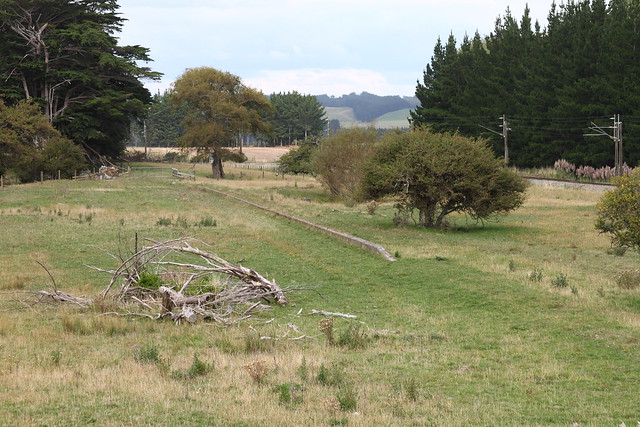
Between July, 1934, and September, 1936, when the measurements were discontinued, the deviation-cutting and embankment were being built, and the use of the tunnel was abandoned. The displacements of the observed points greatly diminished, and after April, 1935, appeared to cease, in part, no doubt, because of the excellent drainage of the fissures afforded by the new cutting, but possibly also because the extra load imposed by the weight of the 87,000 cubic yards of sandstone, which makes the new embankment on the mudstone in the vicinity of the datum point for observations, may have so increased its tendency to creep seaward as to have reduced below the limits of observational error the movement of the tunnel in reference to that of this datum point.

2352_01_011A.tif

The location of this photo is not confirmed, but is possibly the Puketeraki Tunnel, taken in 1910/11. If this is correct, the photo would have been taken at the northern portal near the Puketeraki railway station.

2352_01_012A.tif

Puketeraki Railway Station around 1910/11. As both of these photos were possibly taken by the same photographer on the same day it helps to support the suggestion that the previous photo is the Puketeraki Tunnel.

Both photos are from the Hocken Snapshop being taken by J A Birrell of Dunedin.