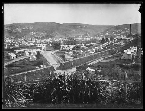
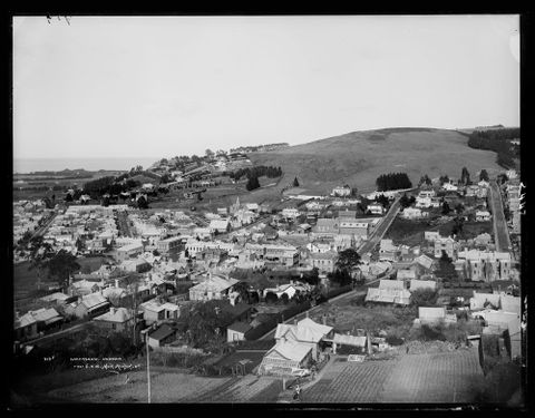
Thursday 25 June 2015

Doigs Ballast Pit - Maps

Well this has taken a long time to put together because it's been so hard to get the aerial photo lined up with Google Earth. When a lot of the terrain covered is now under water you can understand that finding features to match up can be hard work. In the end the photo turned out to cover a lot less riverbank on the true west side than I thought it would.

The 2007 GE ended up being the easiest one to work with due to the amount of shadow in some of the more recent images which made it hard to match up features. 


Halfway to a map. The completed tracings ready to be imported into the map, where they will be checked for their alignment. Misalignment issues are fairly routine for many reasons; since the imagery we are using is not orthorectified, there is naturally distortion of the features, and it's usual that different aerial images will not line up all the way across; GE imagery that has misalignments at the edges is something you see all the time, and this naturally causes positioning errors all across the virtual globe.

Wellington Manawatu Railway, Johnsonville-Tawa Section

As well as having the Cromwell Gorge to look at, I have now decided to take a look at Johnsonville-Tawa at the same time. The original 1885 route of the NIMT was built as the Wellington and Manawatu Railway and became the NIMT in 1908. Due to the steep gradients and consequent limitation of capacity, the Tawa Flat Deviation was constructed and opened in 1937. The route lay abandoned until the late 1940s when work began on the Johnsonville Motorway.


I have determined that Archives New Zealand have in their collection a set of contact prints taken in 1944 covering the footprint shown above. The camera used was a Williamson Eagle IV and the negatives are at a scale of 1:8000. 

Survey 298
Run A
Photo 20,21,22,23,24,25
Run B
Photo 17,18,19,20,21,22,23,24,25,26

This is not a large section in length and with plenty of overlap I won't have to reorder additional images as I am having to do with the Cromwell Gorge section.

Depending on ANZ timeframes I would expect to have the scans in a week or two.

Waipu Branch

From Wikipedia:

Waipu Branch

In 1914, a railway branch line from the North Auckland Line was surveyed to Waipu to serve agricultural activity in the area. Construction of the line was delayed due to World War I, but by 1920, 25 men were employed in the construction of formation. However, by 1924, private motor vehicles were becoming more common and railway lines to sparsely-populated rural areas accordingly became less necessary. Due to the lack of significant industrial activity in the Waipu area, the branch line was no longer seen as economic and construction was cancelled before any rail tracks were laid. However, a new railway line, the Marsden Point Branch, is currently proposed for construction and will follow a route similar to that of the abortive Waipu line.

The real question of course is the route it followed and how much formation work was completed prior to cessation of construction. No route has been found on maps of the period. It seems likely the route would have largely followed State Highway 1 from somewhere near Oakleigh. The Marsden Point route can be found in a Flickr album here.

Waipu's Railway

WAIPU'S RAILWAY.
Northern Advocate , 24 September 1923, Page 4 (courtesy of Papers Past website)
The Hon. J. G. Coates has earned a reputation for straightforwardness and plain speech, and these qualities were prominent in his method of dealing with a deputation of Waipu settlers on Saturday. The request submitted to the Minister of Public Works by the Waipu people was for the improvement of the road which gives Waipu its best connection with the North Auckland railway, the junction being at Taipuha. The deputation received little encouragement. "Scrap your railway," said the Minister, "and we'll give you good roads." Waipu evidently appears to Mr Coates to be "wanting it both ways." It regards as binding on the present Minister of Public Works a promise made by his predecessor to give Waipu a branch railway, and at the same time it claims that a State Department which is facing a considerable expenditure on the railway should also find money for work on roads. The Minister probably has a good deal of sympathy with the Waipu people, who have had to put up with isolation for very many years, and we are sure that this sympathy is shared by everyone who knows the conditions. But Mr Coates very naturally does not feel justified in giving Waipu two outlets, by rail and by road. Actually he believes, as he has stated definitely on various occasions, that he is not justified in giving Waipu a railway, though he is morally bound to honour a promise given by a former Minister of Public Works. The moral argument is, however, a very weak one. "A promise is a promise," but since the late Sir William Fraser definitely promised the Waipu railway conditions have changed. Motor transport has almost effected a revolution, and experience has shown that branch railways are now unprofitable and inefficient. It is possible for Waipu to obtain connection with the North Auckland railway by two easy road routes, one tapping the line at Taipuha and the other at Oakleigh. The Oakleigh Waipu route would probably become part of the scheme of main highways, so that a good road over that, section would always be maintained. The Oakleigh- Waipu railway, however, can only be a costly, inefficient branch. At the best it is not likely to carry more than two or three trains a week; it is not difficult to imagine an occasional "puffing billy" dragging a couple of antiquated passenger cars at a very safe speed. In order to journey south or send goods south Waipu people would have to pay for a very roundabout rail service, while they could save time and money, for themselves as well as for the whole country, by using the road in reference to the railway. The only ground upon which Waipu can base its claim to a railway is that of a former promise. To go on with the railway is simply to fly in the face of all expert opinion. Moreover, Waipu could have good roads long before it is likely to have its railway. To us. and we are sure to every unbiased looker-on, it seems that Waipu would be consulting its own interests and those of the Dominion if it would renounce the railway and content itself with roads.

Tuesday 23 June 2015

Doigs Ballast Pit - Otago Central Railway

According to Dangerfield & Emerson, Doigs Ballast Pit was located at 223.08 km, a short distance east of Doigs Siding at 223.75 km. It was closed early 1964, while Doigs Siding closed early 1970.

Doigs is one of the few areas where there is a significant deviation of the railway from its usual position right next to the road. Although trains leaving Clyde ran on the "railway east" side of the road, the most commonly seen location for the railway in the Gorge was on the "west" or river side.  As can be seen from the above aerial image extract from 1962, the railway at this point crossed to the "east" side of the highway, crossed a small bridge and then veered further away to cross a larger bridge and run directly alongside the ballast pit. According to D&E, the points for the pit siding were right at the edge of the highway. This means probably just before the railway crossed back to the river side. The railway then took a wide deviation to pass around the far side of a property (probably an orchard) before meeting the road again at Doigs Siding.

No maps yet but they will be drawn once all of the aerial imagery for the Cromwell Gorge comes to hand.

NZ Rail Maps Volume 17 Update - Otago Central Railway

Due to the ready availability of aerial photography at affordable prices I am intending to make use of a lot of the available imagery from Archives New Zealand in order to update various maps and the first map apart from the ones drawn for Christchurch (using the Canterbury Maps aerials) will be the Otago Central Railway which is Volume 17 of the NZ Rail Maps published volumes. As time goes on it will be possible to use aerial photography to document a lot of currently unknown information about various features of closed and open railway lines in New Zealand and therefore make an immeasurable contribution to our growing historical knowledge of these lines.

At the present time I am obtaining aerial photography for the Cromwell Gorge and as seen in recent posts have completed drawing a layout of the Cromwell railway station from 1962 and when I have all the photos in about three or four weeks will be in a position to update the maps for that entire section of line from Clyde to Cromwell. This is particularly notable in that the Cromwell Gorge is the only section of railway line in New Zealand to have been buried under a hydro lake and because of this it is one of the few lines we cannot trace the route of at ground level today. 

Once the Cromwell Gorge section is completed the next stage will be to obtain aerial photography for every station yard and other notable features on the rest of the line (the current rail trail) and then update the rest of the maps back to Wingatui. This process will therefore take probably the rest of this year to complete.

From that point on aerial photography will be used where of value to document other branch lines for which I have limited information and particularly yard layouts and other notable aspects of these lines. Therefore other volumes produced to date will be updated as found useful from time to time. An example is the Ngatapa Branch and the legendary three tunnels that are supposed to have been dug at the top end of this line. Probably with at least a few branches where the route is not well known by me then aerials may be used to cover significant sections of the routes. My expectation is that following the completion of Volume 17, the next volume to be worked on will be Volume 10 which covers the Wairarapa Line as this will include full coverage of all the closed routes including the Rimutaka Incline and its approaches and the other realignments within the area. Then the next after that will probably be Volume 9 which is the NIMT from Marton to Wellington, because it incorporates the old WMR line which is of considerable interest to me.

Cromwell Yard Layouts

This is (barring any later corrections) the final set of maps for Cromwell Yard in 1962.


Monday 22 June 2015

More Cromwell aerial photos

After looking at what I got and what I expected to get I have determined that what seems to line up perfectly on the photo alignment layer actually doesn't quite work as expected with the actual images. The best explanation is the contact prints are actually cropped somewhat, and that is the reason why they overlap. What this means in practice is I have to get more images in order to have complete coverage.

So the next request to Archives New Zealand will be for the following images:
  • Survey 1452, Run S, Photo 6: The actual end of the line (and probably the highway as well)
  •  S:1452 / R:T / P:2, 5, 8, 9, 11, 14
  • S:1452 / R:U / P: 6, 7, 9
  • S:1452 / R:V / P: 1, 2, 4, 8, 10
These will give fully overlapped coverage with the ones I already have, enabling me to map all the way down to the dam. 

To ensure coverage of the old Clyde station and anything else in the township area I will also need S 1452 / R W / P 4, 5, 7, 8. These will be put in the same request. For 19 images the cost will be $25 which is only a little over $1 per image. So all very reasonable.

This will enable me to complete the maps for the entire Cromwell gorge, including the various intermediate stations. The aerials are good enough to show where the tracks went at Waenga, and the various bridges, and Doigs ballast pit etc.


Aerial Photography of the Cromwell Gorge

In previous posts, here and here, I detailed my investigations into aerial photography of the Cromwell Gorge and the costs expected. Having found that the Crown Aerial Film Negative Collection would be very expensive to access, the option I am now working with is Archives New Zealand's collection of contact prints that were made from these negatives for Land & Survey's use. Obviously there has been a lot of doubt that these would be of sufficient quality to give a good scan. The negatives for the particular survey I chose were at 1:8000 scale, so 1 mm on the contact print (18x18 cm approx size) would equate to 8 metres on the ground.

Having received my scans today I am very pleased to report that even the low resolution scans are of sufficient quality to pick out the railway line quite clearly on the ground as well as various features. It is not up to the standard of some of the sharpest coverage that Canterbury Maps has of Christchurch, but it does provide enough to be able to pick out the individual tracks in a yard setting.

From here the big difficulty is to overlay the images accurately in GE given that the gorge has changed so much since the advent of the Clyde Dam. It is not only the raising of the two rivers to form Lake Dunstan, but also the extensive works done along the banks in stabilisation work that has changed the appearance of the landscape quite significantly. Getting the overlays in place correctly is essential in order to be able to trace out the various features and place them accurately onto a map.

I am very busy until Saturday so the weekend is probably the time when I will be exploring the whole business of the Cromwell Gorge and the stations along it in more detail. Because the aerials have given such a satisfactory result and have been extremely good value for money so far, I expect that in coming years I will be making extensive use of this Archive New Zealand aerial collection to aid the production of maps. The first priority is the Otago Central line and I expect to obtain aerial images from around the same era of every yard on the line in order to be able to accurately diagram them.

Tuesday 9 June 2015

Old Kensington [2]


This photo by J W Allen from 1875 is of King Edward St crossing with Kensington Station to the left (north). Due to the fact I had originally placed the original Kensington Station on the south side of the crossing this is of interest and I will have to go back to my original source to confirm this. 


This photo also by J W Allen appears to more or less join onto the right of the previous photo, which would make the diverging track in the background the siding into Hillside Workshops. The function of the siding tracks in the foreground is unknown at this time.


This Burton Brothers shot from 1880 is clearly marked "Hillside" and obviously the same location as the previous photo. (Hocken Library) http://hockensnapshop.ac.nz/nodes/view/9803

Sunday 7 June 2015

Old Kensington


Hillside Workshops around 1900 with the old main line in the foreground.

Old Caversham [2]


This is a Burton Bros shot overlooking the old railway line at the bridge over South Road. On the far right we have the old Caversham Gasworks. These days the motorway corridor occupies a considerable amount of the foreground with the railway on the far side of it.

Original from Te Papa Collections

Old Caversham [1]


The top photo is a Muir and Moodie from 1905. The bottom photo is from Google Earth in 2009. The white arrow on both images denotes the same landmark - Caversham Presbyterian Church. In the top photo you can see the old railway line crossing horizontally (you need to view the full size download from Te Papa Collections to see it). In the bottom photo the place of the old railway line (closed more than 100 years ago) is taken by the motorway, the advent of which has greatly changed Caversham.


Dunedin-Mosgiel Railway Duplication: Brief Synopsis

This was a major project that occupied some 8 years from 1906-1914. It entailed that the original line had to be kept in operation throughout. I will update this article with more information as time goes on and I do more reading but between Dunedin and Caversham this appears to be the construction methods used:
  • The new line was built on a separate alignment but directly alongside the existing line, all the way from Dunedin to Wilkie Road. This was because new bridges had to be built at Andersons Bay Road, King Edward Street and Wilkie Road. The means adopted was to make these as temporary bridges until such time as the new line could become the running line. The permanent bridges had to wait until the original line was taken out of use, which suggests they ended up cutting into the old formation. Nevertheless photos do exist showing old and new lines side by side but the old line must have been impassable by the time the permanent bridges were completed.
  • The embankment was formed from trestling that was filled in with spoil tipped from railway wagons, a common semi-mechanised method of constructing large railway embankments at that time. It contrasts with the use of pick and shovel and horse drawn vehicles used in other railway projects in NZ where a locomotive was not available to help with the work.
  • The original line was on the north or west side of the new embankment.
  • Past Wilkie Road to South Road, there was already a bridge over South Road for the existing line so the embankment was widened to take two tracks and the second track laid on the north or west side. There must have then been a second bridge provided for the new track.
  • Heading into Caversham the new station was in a different place and at a lower level, so there was a divergence from the old line again, probably just past the bridge over South Road. The new line was placed into a cutting as it approached the new tunnel at Caversham, and a number of bridges were built to take the various local streets as well as South Road over the cutting. This bridge which is a large steel structure on a big skew, was bypassed by the motorway construction in the 1980s and remains at the end of Caversham Place, just south of the tunnel portal.
  • The tunnel construction was started at the very beginning of the project, because the fill from the approach cutting and the tunnel itself were used to build up the embankment from Dunedin to Caversham.
  • Motorway construction in the 1980s resulted in big changes with essentially the pre-1914 route and part of the duplication route through Caversham taken over for the road. The railway at that time was singled and diverted, with a new embankment built from just past Wilkie Road behind Carisbrook Stadium, to the site of Caversham Station, incorporating a new bridge over South Road. South Road was diverted onto the overbridge at Barnes Drive leaving the old overbridge as a dead end, with the stub road renamed Caversham Place. Caversham itself was cut in half by the motorway and four overbridges just south of Barnes Drive were removed. The overbridge at Goodall St remains for access to the footbridge over the motorway itself. There have been further changes since with the doubling of the highway in the last few years.
  • The only remnant to be found of the old construction through the area is the old tunnel. The approach cutting has a footbridge over it at Lindsay Road giving a view down into the tunnel portal. The portal at the other end is currently fenced off.

Old Dunedin Railway Station


Trains and railway tracks at Dunedin railway station. Ref: 1/2-021048-F. Alexander Turnbull Library, Wellington, New Zealand. http://natlib.govt.nz/records/22905148

This is thought to be in the 1890s.

Saturday 6 June 2015

Dunedin-Mosgiel Railway Duplication [3]


Another photo from the Dunedin railway improvement works more than 100 years ago. This one shows the work between Wilkie Road and South Road, the bridge for which can be seen in the background. On the left is the site of Carisbrook Stadium. The railway today passes much closer to the Carisbrook site because the embankment was moved in the 1980s when the motorway was put through. It looks like here that the original line is simply being added to, it being possible to continue the use of it at this point because the bridge at South Road merely needed to be extended, so the second track was simply laid alongside the first

Dunedin-Mosgiel Railway Duplication [2]


Another series of photos from 1907. The first three photos show various grade separation bridges under construction, with the one at Wilkie Road again being in the large centre photo. The existing line is clearly climbing in the right of this photo - my estimation was that the lines would have been at equal height by the time of reaching South Road, which was a bridge on the original line. You can see the original line appearing to cross a bridge in the background - probably a stream, not South Road itself. As I noted the new bridges were all built alongside the existing line, whereas existing bridges were in some cases built up to the new height and the existing line simply raised higher.

This is interesting because it should have been possible to build half a bridge then build one of the new lines onto it, make that the running line and then do the other side on top of the existing line, but clearly that was not the technique used because of the photos which clearly show three tracks at various places.

Dunedin-Mosgiel Railway Duplication


This set of photos include in a number of cases views of the new line alongside the old. I was originally given to understand that the original line in some areas was lifted up but clearly this would not have been possible in all areas. The centre photo appears to be taken at Wilkie Road where they had a lot of fun with a sewer main that collapsed under the weight of the embankment. So in general I would guess that where a new bridge was needed then the bridge was built complete and the new lines were put onto the bridge, the old line was alongside and was later removed. It was possible at existing bridges in some cases to lift up the bridge, for example Abbots Creek, where the abutments were raised in stages. In general these photos imply that the old line was on the north or west side of the current line almost all of the time and did not cross over to any extent. I will be attempting to incorporate this knowledge with existing documentation to draw in the old line on the maps wherever possible because it does seem reasonably clear for the first time that most of the new construction was alongside rather than part of the work being raising of an existing line as the descriptions I have read are rather ambiguous.